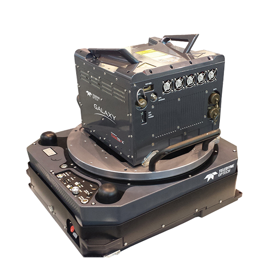
Optech Galaxy
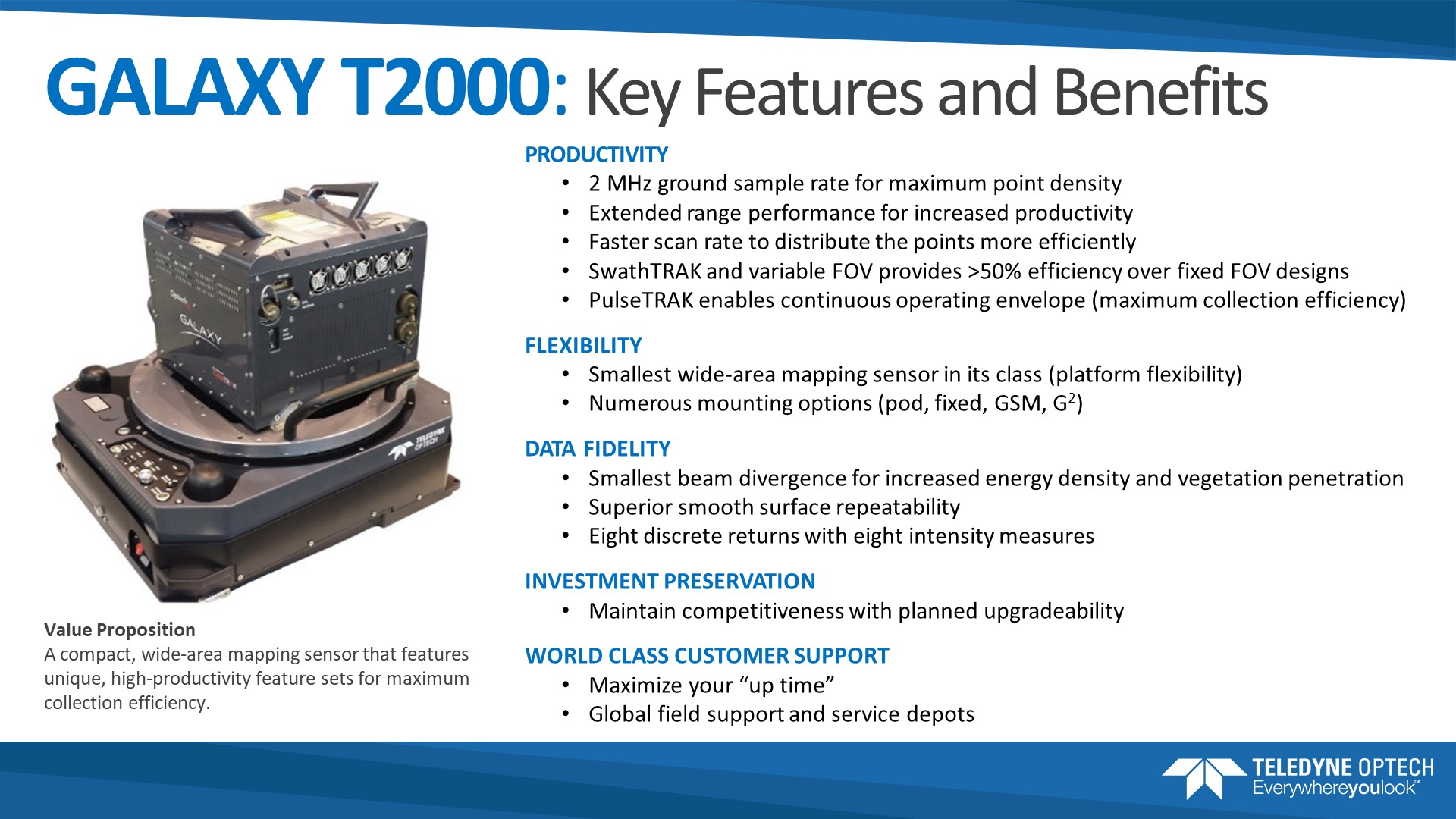
Galaxy is the next generation of airborne solutions, packing more power and accuracy into a tiny footprint than any other sensor. Designed for everything from wide-area mapping to corridor surveys, Galaxy is truly a universal sensor that rivals larger systems with its ultra-dense data and industry-leading measurement precision and accuracy.
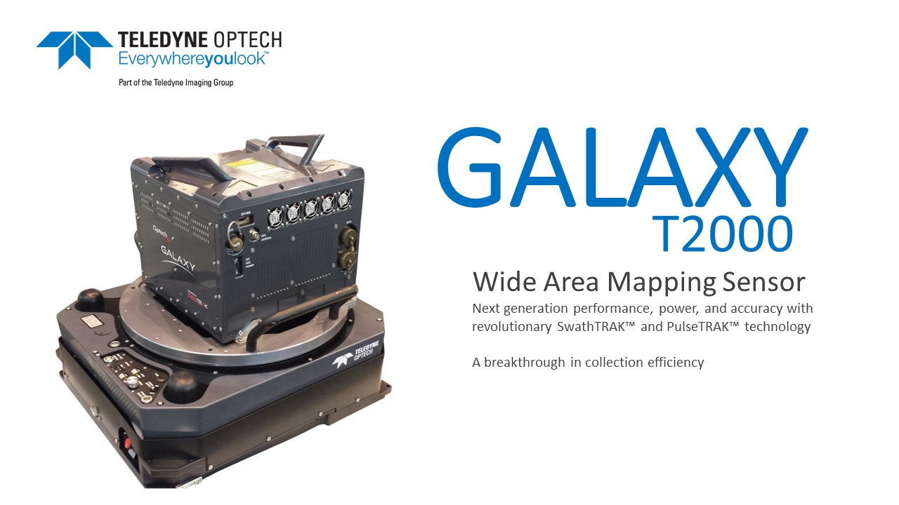
A breakthrough in collection efficiency
Galaxy’s new PulseTRAK™ and SwathTRAK™ technologies (patents pending) make surveying simpler than ever before by providing unique innovative feature sets that maximize productivity, increase information content and reduce overhead costs.
Whether installed in a tactical UAV, integrated in a helicopter pod for powerline surveying, or gyro-stabilized with an orthometric camera for wide-area mapping, Galaxy’s performance and capability is out of this world.
Features & Benefits
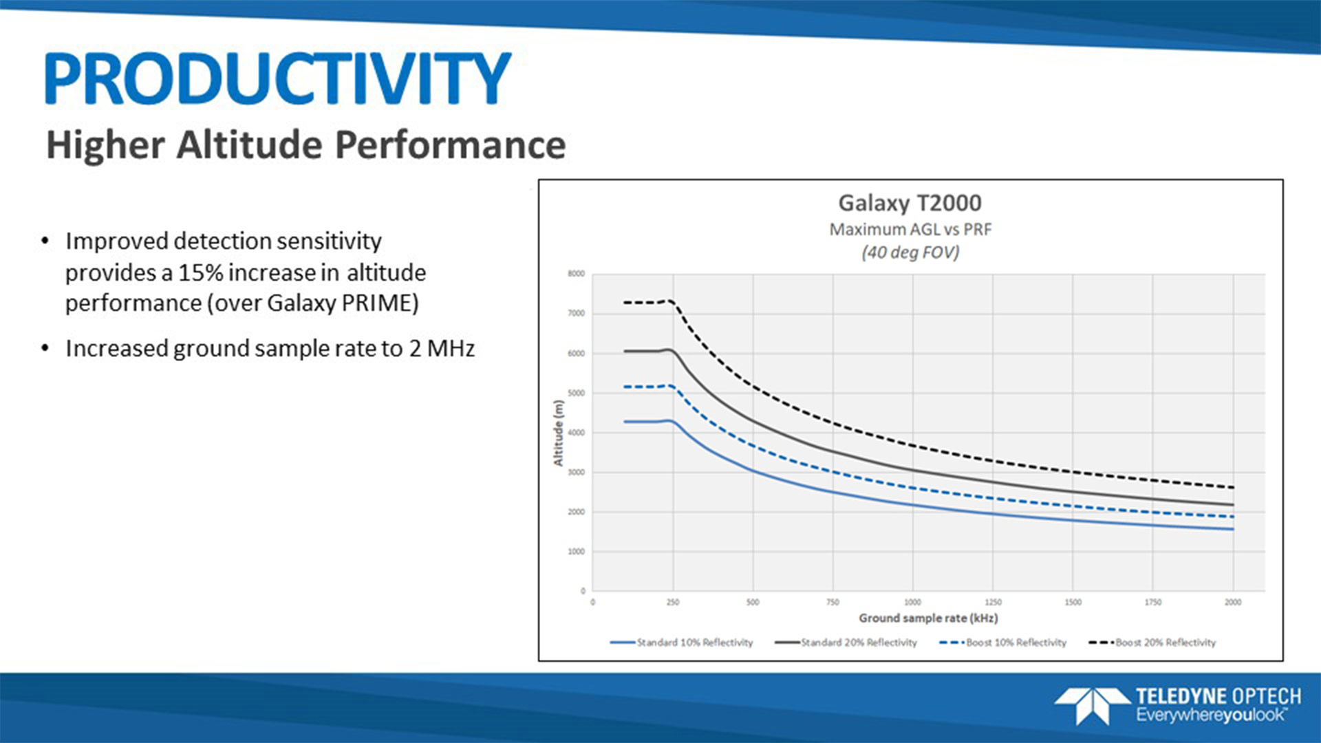
- PulseTRAK technology replaces conventional multi-pulse technologies for high PRFs at high altitude
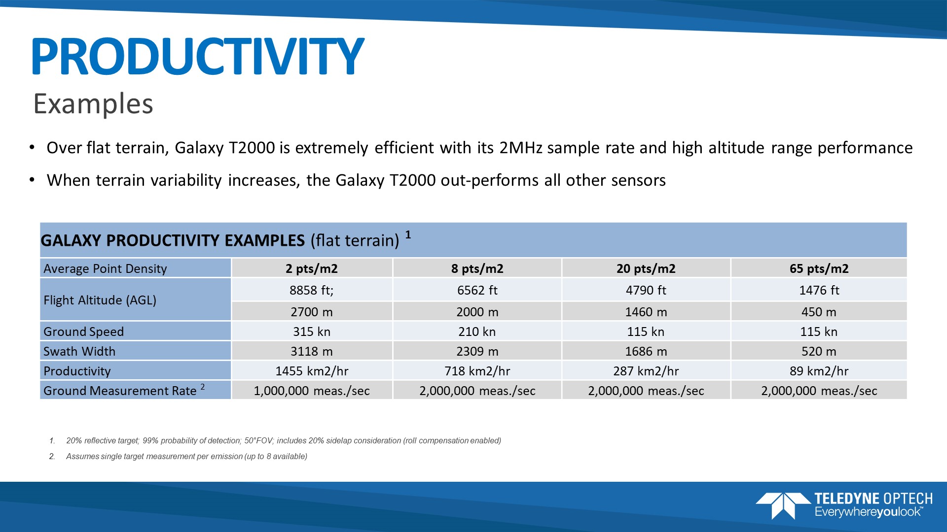
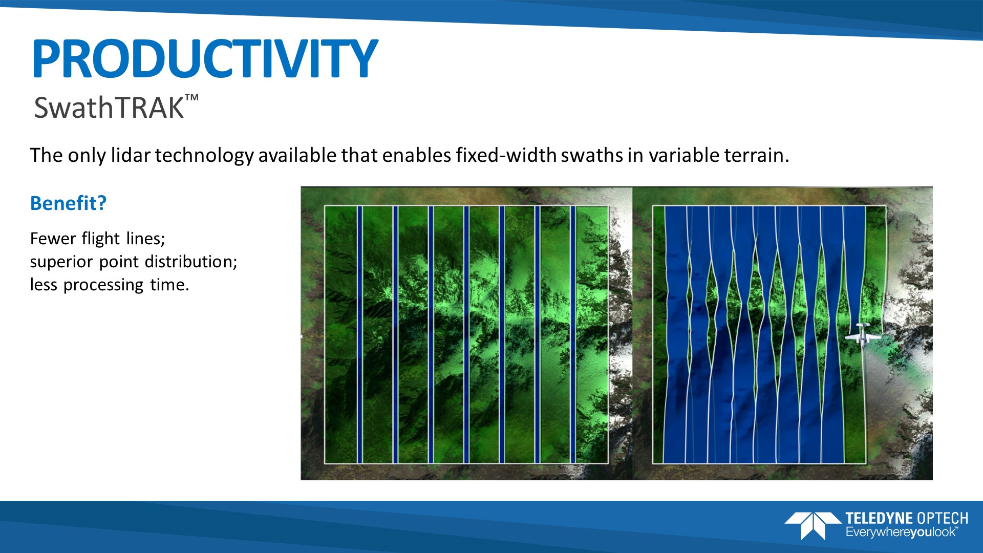
- SwathTRAK technology moves collection efficiency to a whole new level by dynamically modifying the scan field of view during collection to maintain fixed swath widths and even point distribution, even in variable terrain
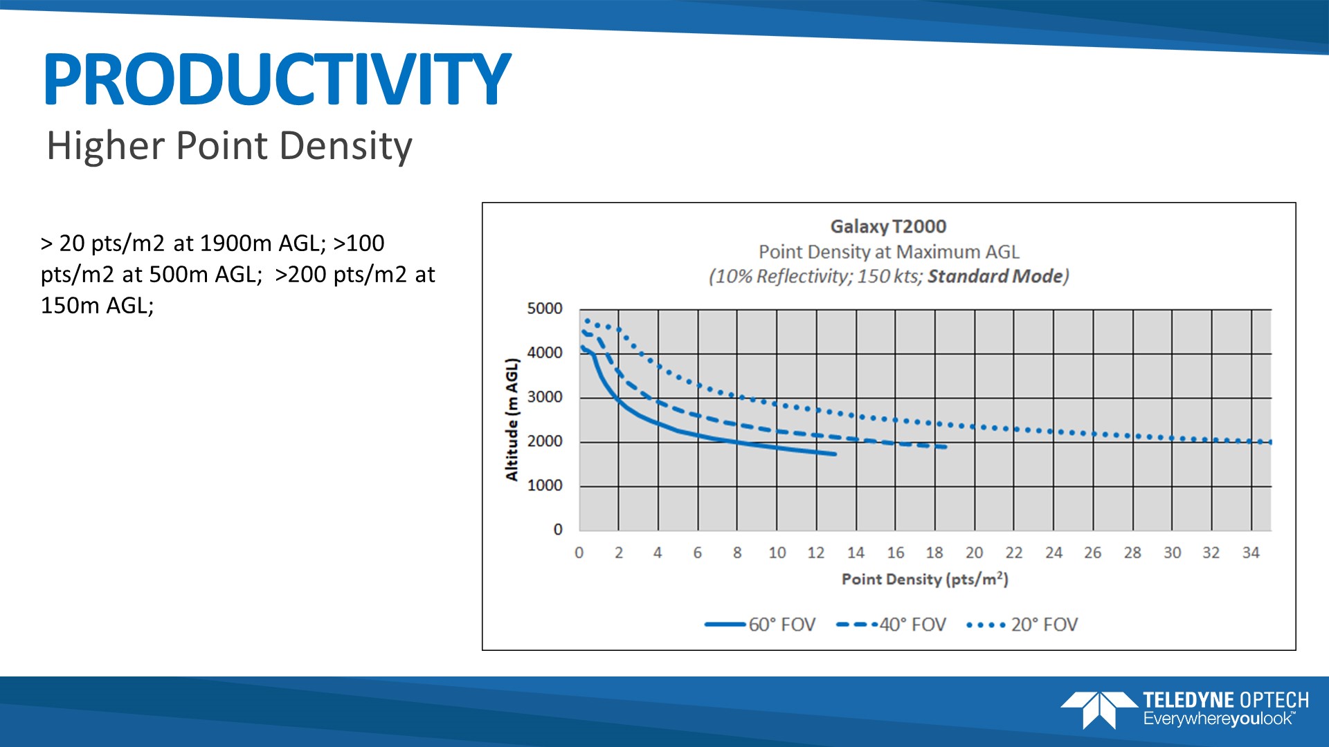
- 2 MHz effective PRF provides on-the-ground point density and efficiency formerly reserved for dual-beam sensors
- Industry-leading data precision and accuracy for the highest-quality datasets possible
- Up to 8 returns per pulse provide increased vertical resolution of complex targets without the need for full waveform recording and processing (waveform recorder optionally available)
- Trusted Platform Module 2.0
- Industry-leading discrete timing electronics for pulse pair separation (i.e. minimum target separation distance) of less than 0.7 m (or less with optional waveform recorder)
- Wide dynamic range enables exceptional small-target detection capability and capture of even the smallest details
- Real-time XYZI point clouds in LAS format enable immediate data deliverables
- In-air lidar point cloud display for maximum collection confidence
Applications
- Wide-area mapping
- Powerline and transportation corridor
- 2 MHz effective PRF provides on-the-ground point density and efficiency formerly reserved for dual-beam sensors
- Natural Resource management
- Engineering and infrastructure modeling
- Urban Mapping
- Defense & Security
Accessories
- Integrated multi-camera systems
- Full waveform recorder
- Multi-sensor fixed mounts
- Helipods
- Gyro-stabilized survey kits
Optech Galaxy
Production-focused workflow software with automated calibration and boresight capability using rigorous least squares methods and robust bundle block adjustment for both lidar and camera within a single workflow, enabling truly coincident datasets and quantified accuracies
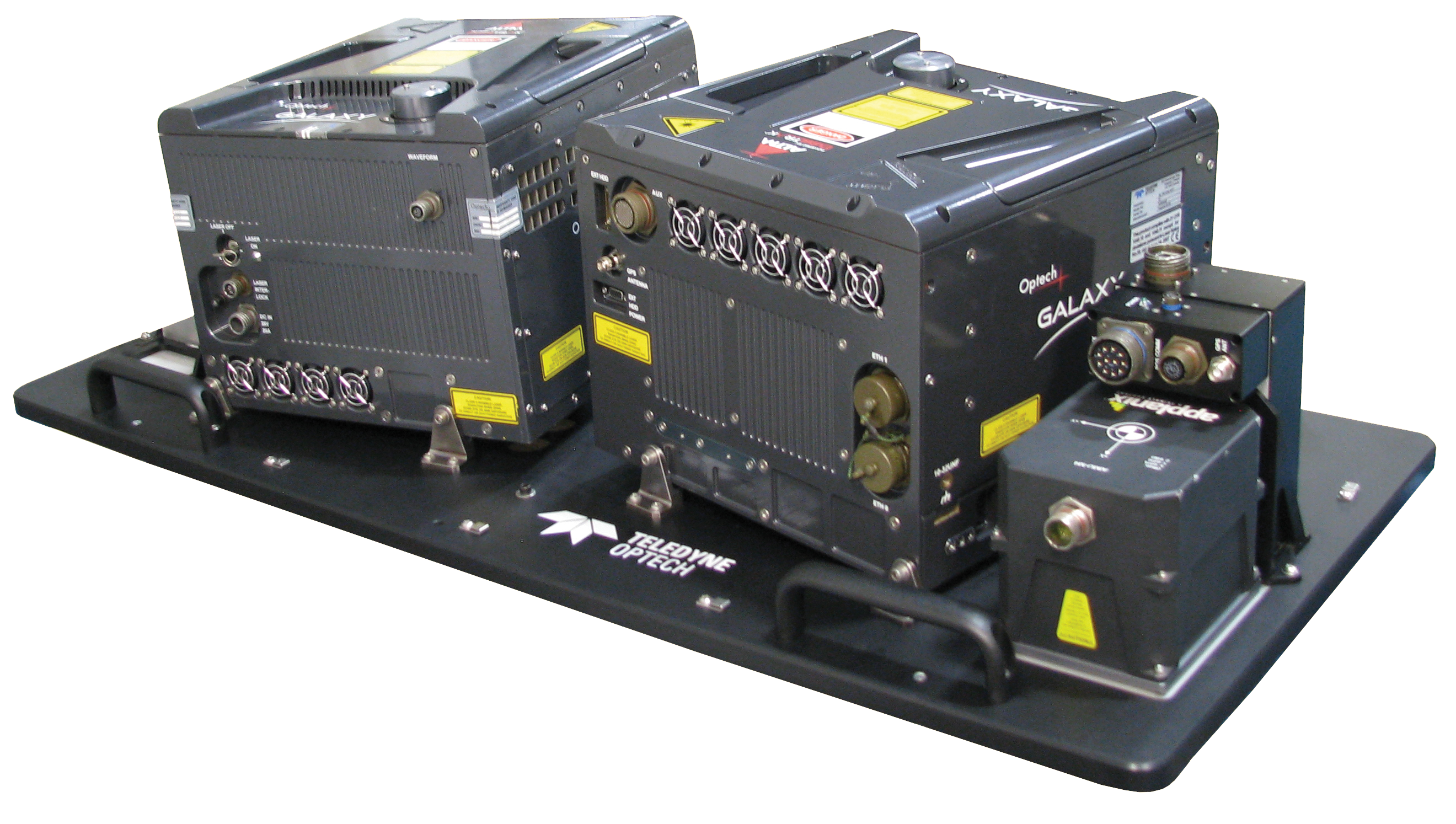
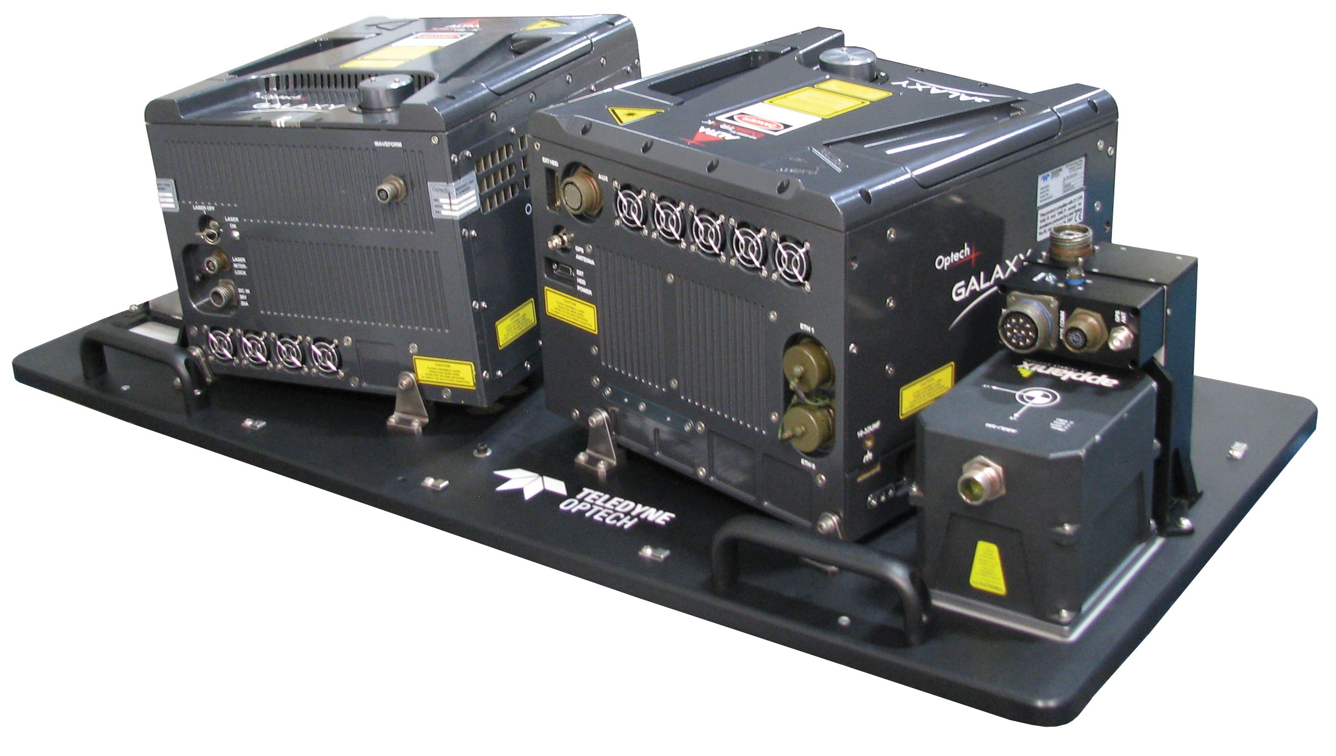
The G2 Sensor System
Teledyne Optech’s new G2 sensor system for the ALTM Galaxy is the perfect solution for doubling your collection efficiency and productivity on those really large survey projects.
Designed specifically for the USGS 3DEP lidar program collections, the G2 sensor system enables efficiency and resolution comparable to FLASH lidar while maintaining independent range measurement and superior data fidelity.
Leveraging the compact form factor of the award winning ALTM Galaxy, the G2 sensor system combines two Galaxy sensor heads and a 150MP camera over a standard 19" aircraft sensor portal.
OPTECH GALAXY TECHNICAL SPECIFICATIONS
Brochure / Documment
| Galaxy T2000 Brochure | Download PDF 1 Download PDF 2 |
|---|---|
| Galaxy PRIME+ Brochure | Download PDF |
| Galaxy PRIME Brochure | Download PDF |
PRODUCT TOUR
OPTECH GALAXY Accessories
Brochure / Documment
| Galaxy T2000 Brochure | Download PDF 1 Download PDF 2 |
|---|---|
| Galaxy PRIME+ Brochure | Download PDF |
| Galaxy PRIME Brochure | Download PDF |
Accessories
- Integrated multi-camera systems
- Full waveform recorder
- Multi-sensor fixed mounts
- Helipods
- Gyro-stabilized survey kits
Lidar Systems
Production-focused workflow software with automated calibration and boresight capability using rigorous least squares methods and robust bundle block adjustment for both lidar and camera within a single workflow, enabling truly coincident datasets and quantified accuracies
.jpg)
.jpg)
.jpg)
.jpg)
.jpg)
.jpg)
.jpg)
.jpg)